Seeing through the Mud - Mapping Mudflats and Potential Pollution
GIS maps are excellent tools for determining the general outline and characteristics of the drainage areas, as well as providing an estimate of the potential number and variety of pollution sources. GIS maps are like a "data sandwich" where multiple sets of data are layered to illustrate patterns of pollution risk or "hotspots" in the watershed.
WCCOG developed a web-based map, allowing users to access information about point and non-point sources of pollution in relation to specific clam flats. The web-based map is the first step in a planning tool, leading users to specific steps that increase economic productivity and reduce land-based sources of pollution:
- Education and Services provided by WCCOG
- The Landowner Toolbox contains actions available to address water quality
- The Municipal Toolbox contains resources available to local officials
Planners Maps, developed by the University of Maine at Machias with WCCOG for GroWashington-Aroostook, show many layers including shellfish habitat. These maps are very useful now, and will continue to be developed to show more data, similar to the data contained in the other maps below.
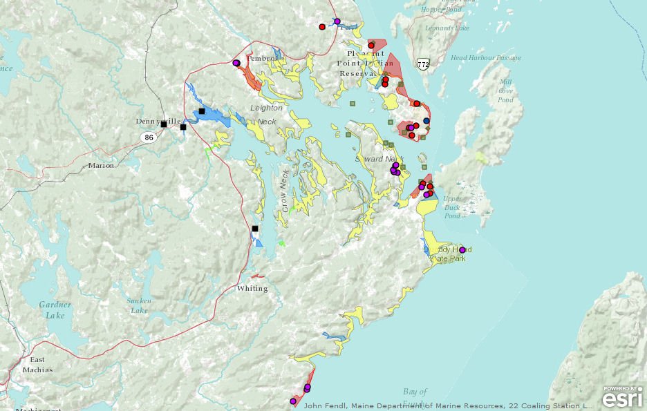
The following maps are a snapshot in time. The layers from 2011 and before were assembled by WCCOG with the assistance of Heidi Leighton and Brett Jones (both graduates of the University of Maine at Machias GIS mapping program of study). These are depicted on 3 sub-regions of the Washington County coastline:
| Data Layer | Description | Source |
| Metwp24 | Town Boundaries | Maine Office of GIS |
| EastME_Shell_Class2011 | Shellfish Area Classifications | John Fendl, Maine Department of Marine Resources |
| Farms_process | Farms | UMM GIS Service Center |
| marine_sewage_pumpouts | Marine Sewage Pumpout Sites | Maine Department of Environmental Protection |
| obd | Overboard Discharge Permit Sites | Maine Department of Environmental Protection |
| softshell_clams | Soft-shell Clam Habitat Areas | Maine Office of GIS |
| wwtf_outfalls | Wastewater Treatment Facility Outfall Sites | Maine Department of Environmental Protection |
| wwtp_facilities | Wastewater Treatment Facilities | Maine Department of Environmental Protection |
Given its considerable length we have broken up the coastline of Washington County into 3 map sections below.
Click on the map image to open a new window of each area. To use the map, zoom to the location of interest using the navigation tools in the bottom left hand corner of the map. Move your mouse over the bottom left hand corner to make the navigation tools appear. Once zoomed in to the area of the map you would like to explore, click on any symbol to reveal a pop-up box with information about that specific location.
Before harvesting shellfish, it is necessary to check with Maine Marine Patrol before, because this data is constantly changing.
 Menu
Menu


