Scenic Byways - The Bold Coast & Black Woods
The Maine Scenic Byways Program
 The Maine Scenic Byways program is a community-based consensus and partnership program administered by the Maine Department of Transportation (MaineDOT). The Byway program promotes economic development along roadways that offer the traveler an opportunity to experience exceptional scenic, cultural, recreational, archeological, and historical qualities. The ultimate goal of the Program is to preserve, maintain, protect and enhance Maine’s unique intrinsic resources.
The Maine Scenic Byways Program will preserve, maintain, protect and enhance the intrinsic resources of scenic corridors through a sustainable balance of conservation and land use. Through community-based consensus and partnerships, the program will promote economic prosperity and broaden the traveler’s overall recreational and educational experience.
Scenic Byway designation promotes economic development by:
- Introducing visitors to the beauty, solitude, and rejuvenating qualities of the landscape;
- Providing access to the numerous recreational opportunities;
- Sparking curiosity about the people, culture, and history of the region; and
- Enticing patrons to local businesses and community events and celebrations.
The Maine Department of Transportation and the Maine Office of Tourism (MOT) are important partners in promotion and program development. State designation of the Byway places the region on the State’s Scenic Byways map, the MaineDOT Explore Maine webpage, and on the Maine Office of Tourism (MOT) webpages and brochures.
The Black Woods Scenic Byway
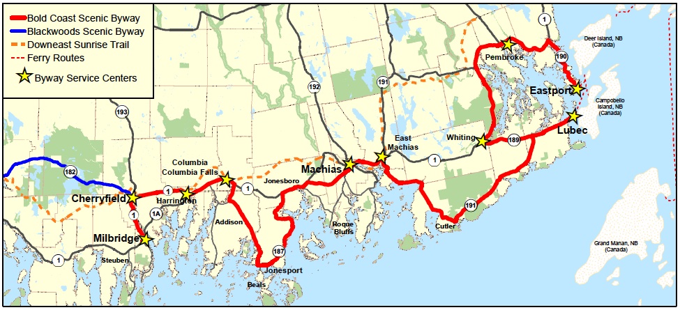
The Blackwoods Scenic Byway, designated in 2004, is located on State Road 182 between the towns of Hancock (in Hancock County) and Cherryfield (in Washington County). Route 182, locally known as the Blackwoods Road, is a remarkable journey. Traversing the twelve and a half miles that connect two historical New England villages, visitors experience forests, ponds, lakes, streams, rocky hills, blueberry barrens, small farms and cottage businesses.
Backwoods recreation opportunities abound along the Blackwoods Byway. Public access to Fox Pond, Tunk Lake, Long Pond and Spring River Lake provides summer and ice fishing, swimming, and boating. Just off of the byway a network of trails crisscrosses public lands in an area known by some as "Little Switzerland." Hiking, camping, fishing, bird-watching and hunting are there for the adventurous.
Local historians still tell tales of mysterious visions from the crest of Catherine's Hill, or 19th century gold and silver mining boondoggles and of the brave few who made their homes in this wilderness during long Maine winters. Cherryfield, the wild blueberry capital of the world, is a living document of the impact of timber, boat building and blueberries. Franklin and Cherryfield, the village anchors at each end of the byway, are home to dozens of historic homes, some over 200 years old. Several historic sites have appeared in Yankee and Downeast magazines.
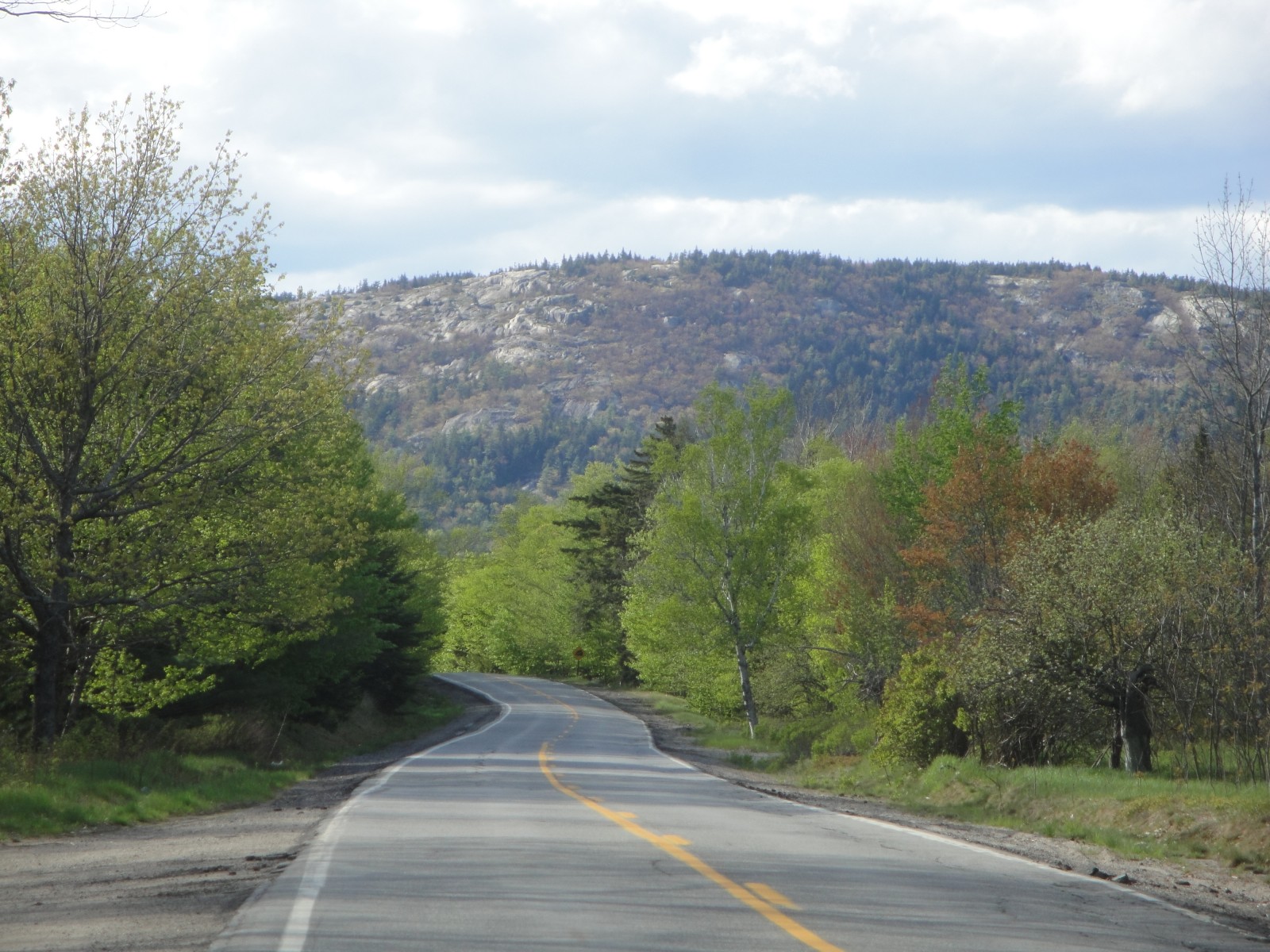
The scenery is northern New England spectacular. Amidst dense forests, breath-taking views emerge from ridge-lines and open expanses of water. The land here is hard; a mix of rock, pine needles, serpentine tree roots and icy streams. Summers are delightfully cool, autumns present a brilliant display of color and winters are pronounced with snow, thick lake ice and a quiet that is seldom experienced elsewhere. Rocky fields of wild blueberries, the region’s primary agricultural export, are visible on some portions of the byway. The state’s largest blueberry producing region is just minutes away. These blueberry barrens create a carpet of green in the spring, blue in the late summer and fiery red in the autumn.
The Bold Coast Scenic Byway
 The Bold Coast Scenic Byway is a 125-mile driving route that invites visitors to explore the culture, history, wildlife, and rugged, unspoiled beauty of coastal “Downeast” Maine. The byway route is strung with active fishing harbors and downtowns composed of historic structures that exemplify the wealth of 19th Century ship captains and lumber barons; as well as the industrial history of the shipping, lumbering, fishing, boatbuilding, and canning trades. The byway route winds its way along the coast, passing through wild blueberry barrens; abundant farmland; coastal forests; tidal marshes and bays; and clear-flowing rivers, streams, and lakes.
The Byway route extends from the fishing community of Milbridge northeasterly through coastal and riverine villages to Lubec, the easternmost point of land in the United States and gateway to Canada’s Campobello Island; and skirts the coastline of Cobscook Bay, through the Pleasant Point Indian Reservation to Eastport, an historic fishing port overlooking international waters and the Fundy Isles of New Brunswick, Canada.
The Bold Coast Scenic Byway was officially designated as a Maine Scenic Byway on June 8, 2011. It is the longest scenic byway in Maine.
The Eligibility Application that led to the the designation of the Bold Coast Scenic Byway in June of 2011 can be downloaded here: (Full application, PDF 14 MB).
As a Maine Scenic Byway, the WCCOG was eligible to apply for and received a $100,000 grant through the National Scenic Byways Program to develop the Bold Coast Byway Corridor Management Plan.
News Coverage
Maine’s Bold Coast: Chronicle New England Main Streets: WCVB TV Boston
Four 5-minute video clips produced in July, 2013 as a 1/2 hour television program. Each clip highlights some of the many very special people and places in the Bold Coast Region.
To DOWNLOAD the entire 20-minute video, click here.
more-maine-fishermen-finding-success-supplementing-incomes-by-offering-tourist-cruises/
Bangor Metro “Talk of the Town” (August 2013) – Talk-of-the-town/Bold-Coast-Scenic-Byway
Bangor Daily News “Washington County orchestrates Bold Coast Scenic Byway project” (April 2013) – down-east/washington-county-orchestrates-bold-coast-scenic-byway-project
 Menu
Menu
